
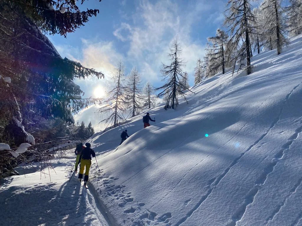
14 tours in the Carnic Alps and Lesachtal. We help with planning, equipment hire and finding guides.
Before every tour: Check the avalanche bulletin, weather, snowpack, slope aspect and access. Carry a transceiver, probe and shovel and know how to use them. Difficulty ratings describe the route; they do not imply it is safe in the current avalanche conditions.
Easy · Shorter ascents
Vorhegg 1.200 mA beginner’s tour on the doorstep.
- Distance
- 2.8 km
- Ascent time
- 1:25 h
- Elevation gain
- 493 m ascent
- Drive from Mauthen
- 0 min
- Difficulty
- EASY
An uncomplicated introduction to ski touring in Kötschach-Mauthen. The former ski slope on the Sonnenhügel is suitable for practising technique, first kick turns and a short training outing.
Start: Kötschach-Mauthen · Altitude: 1,200 m
Route: Kötschach - Vorhegg / former ski slope - return
LONCIUM tip
Ideal for your first touring day or a quick outing. Check current snow and terrain conditions here too.
Lackenalm 1.612 mA gentle Lesachtal tour.
- Distance
- 4.0 km
- Ascent time
- 1:30 h
- Elevation gain
- 417 m ascent
- Drive from Mauthen
- Approx. 30 min
- Difficulty
- EASY
A short, scenic ski tour to one of Lesachtal’s best-known alpine pastures. The ascent starts on a prepared track, then continues over open alpine meadows where appropriate.
Start: St. Lorenzen / Lesachtal · Altitude: 1,612 m
Route: St. Lorenzen - forest track - open alpine meadows - Lackenalm
LONCIUM tip
Good for beginners. For more, continue to Lackenkreuz: about 100 additional metres of ascent.
Moderate · Mountain days with experience
Samalm 1.991 mPanorama above Maria Luggau.
- Distance
- 6.6 km
- Ascent time
- 2:45 h
- Elevation gain
- 850 m ascent
- Drive from Mauthen
- Approx. 45 min
- Difficulty
- MODERATE
A Lesachtal classic with a steady ascent and wide views. On a clear day, the summit plateau looks out from the Sexten Dolomites to the Karawanks.
Start: Maria Luggau · Altitude: 1,991 m
Route: Maria Luggau - mountain meadows / forest - Samalm cross - return
LONCIUM tip
One of the tours we particularly like to suggest to guests with some experience. Descend broadly along the ascent route.
Runseck 2.119 mThe popular Lesachtal classic.
- Distance
- 6.1 km
- Ascent time
- 3:00 h
- Elevation gain
- 1.080 m ascent
- Drive from Mauthen
- Approx. 25 min
- Difficulty
- MODERATE
One of Lesachtal’s most popular ski tours. Forest tracks, larch meadows and pastures lead to a generally steady ridge. Comparatively straightforward technically, with impressive scenery.
Start: Nostra / Birnbaum · Altitude: 2,119 m
Route: Nostra - alpine track - larch meadows - ridge - Runseck - return
LONCIUM tip
Important: do not descend into Niedergail or Wolayertal. The official route recommendation is to descend near the ascent track.
Wodnertörl 2.059 mAn introduction to the Carnic Alps.
- Distance
- 5.0 km
- Ascent time
- 2:45 h
- Elevation gain
- 1.000 m ascent
- Drive from Mauthen
- Approx. 15 min
- Difficulty
- MODERATE
A rewarding tour amid the Carnic Alps’ dramatic rock scenery. The approach through Valentintal passes the alpine pastures to Wodnertörl and offers a fine introduction to this touring area.
Start: Plöckenpassstraße / Valentintal · Altitude: 2,059 m
Route: Plöckenstraße - Untere Valentinalm - Obere Valentinalm - Wodnertörl
LONCIUM tip
A strong LONCIUM recommendation for experienced ski tourers visiting Valentintal for the first time.
Valentintörl 2.144 mBetween Hohe Warte and Kellerspitzen.
- Distance
- 6.0 km
- Ascent time
- 2:50 h
- Elevation gain
- 1.070 m ascent
- Drive from Mauthen
- Approx. 15 min
- Difficulty
- MODERATE +
One of the finest classic ski tours near Kötschach-Mauthen. Beyond Obere Valentinalm an impressive basin opens below the mighty walls of Hohe Warte and Kellerspitzen.
Start: Heldenfriedhof / Valentinalm junction · Altitude: 2,142 m
Route: Plöckenstraße - Untere Valentinalm - Obere Valentinalm - Valentintörl
LONCIUM tip
The pass is a wonderful destination in its own right. Continue towards Rauchkofel only in suitable conditions.
Difficult · Polinik & Rauchkofel
Polinik 2.332 mThe great mountain above Kötschach.
- Distance
- 6.8 km
- Ascent time
- 3:15 h
- Elevation gain
- 1.108 m ascent
- Drive from Mauthen
- Approx. 15 min
- Difficulty
- DIFFICULT
A demanding ski tour on the distinctive local mountain above Kötschach-Mauthen. Terrain becomes more alpine with height; safe conditions, fitness and experience are essential.
Start: Plöckenhaus / Plöcken area · Altitude: 2,332 m
Route: Plöcken area - Spielboden / pass area - Polinik - return
LONCIUM tip
Not for beginners. Assess snow, wind and avalanche conditions conservatively, especially near the summit.
Rauchkofel 2.460 mA Carnic spring classic.
- Distance
- 13.6 km
- Ascent time
- 3:00 h*
- Elevation gain
- 1.390 m ascent
- Drive from Mauthen
- Approx. 15 min
- Difficulty
- DIFFICULT
A magnificent and serious ski tour below the highest walls of the Carnic Alps. From Valentintörl the route enters steeper terrain and crosses the south-facing slope to Rauchkofel; the final summit ascent may be on foot.
Start: Plöckenpassstraße / Kreuztratte · Altitude: 2,460 m
Route: Valentintal - Obere Valentinalm - Valentintörl - south-facing slope - Rauchkofel
LONCIUM tip
Especially beautiful in good spring firn conditions. *Times vary by source and variant; allow generously for the whole day.
Lesachtal · More tours
Xaveriberg - Samalm - TuffbadThe scenic traverse.
- Distance
- 8.0 km
- Ascent time
- 3:00 h
- Elevation gain
- 880 m ascent
- Drive from Mauthen
- Approx. 35 min
- Difficulty
- MODERATE
A varied traverse with a south-easterly aspect. Meadows, mountain forest and sparse larches lead to the Samalm plateau; the descent goes via Wieseralm to Tuffbad.
Start: Xaveriberg / St. Lorenzen · Altitude: 1,992 m
Route: Xaveriberg - Samalm cross - Wieseralm - descent to Tuffbad
LONCIUM tip
Plan transport: start and finish are different. Two cars or an arranged transfer make it easier.
Schönjöchl 2.294 mNorth-facing. Snowy. Classic.
- Distance
- 5.9 km
- Ascent time
- 3:30 h
- Elevation gain
- 1.200 m ascent
- Drive from Mauthen
- Approx. 35 min
- Difficulty
- MODERATE
A true Upper Gailtal classic. An alpine track gives way to open terrain; the sheltered north-facing location often preserves usable snow well into spring.
Start: Mühlenstüberl / Obergail · Altitude: 2,294 m
Route: Obergail - Obergailer Alm - Enderberghütte - basin - Schönjöchl
LONCIUM tip
Fitness matters more than technical finesse. In spring, take daytime warming into account.
Wasserköpfe 2.247 mBroad slopes in Obergailertal.
- Distance
- 6.3 km
- Ascent time
- 3:30 h
- Elevation gain
- 1.100 m ascent
- Drive from Mauthen
- Approx. 35 min
- Difficulty
- MODERATE
A varied ascent with particularly beautiful open upper slopes. The shaded high valley can preserve snow for a long time; the summit slope itself requires careful assessment.
Start: Mühlenstüberl / Obergail · Altitude: 2,247 m
Route: Obergail - Obergailer Alm - high valley - Wasserköpfe
LONCIUM tip
If the summit slope raises doubts, the plateau below is already a rewarding and sensible destination.
Mittagskofel 2.221 mThe panoramic peak above Niedergail.
- Distance
- 6.0 km
- Ascent time
- 4:00 h
- Elevation gain
- 1.180 m ascent
- Drive from Mauthen
- Approx. 30 min
- Difficulty
- MODERATE +
A long, rewarding tour to one of Lesachtal’s viewpoints. Terrain is comparatively gentle up to the plateau above Liesinger Hochalm; the final summit ascent is steeper.
Start: Niedergail · Altitude: 2,221 m
Route: Niedergail - alpine track - Niedergailer Alm - plateau - east slope - Mittagskofel
LONCIUM tip
If conditions on the summit slope are unsuitable, the plateau above the pasture is a sensible alternative.
Frohntal - Hochalpl 2.385 mLong. Quiet. Alpine.
- Distance
- 7.1 km
- Ascent time
- 3:30 h*
- Elevation gain
- 1.093 m ascent
- Drive from Mauthen
- Approx. 40 min
- Difficulty
- DIFFICULT
A magnificent tour in a secluded valley head. Via Ingridalm and Hochweißsteinhaus to Bladener Joch, then more technical terrain across ridges and cirques towards Hochalpl.
Start: Frohn / Lesachtal · Altitude: 2,385 m
Route: Frohntal - Ingridalm - Hochweißsteinhaus - Bladener Joch - Hochalpl
LONCIUM tip
Ski crampons strongly recommended. This variant requires excellent avalanche assessment skills. *Ascent time.
Schwalbenkofel - Schulterhöhe 2.424 mOnly in suitable conditions.
- Distance
- 5.4 km
- Ascent time
- 3:30 h
- Elevation gain
- 1.250 m ascent
- Drive from Mauthen
- Approx. 50 min
- Difficulty
- DIFFICULT
A varied, demanding ski tour. Schwalbenkofel is often possible over a longer part of winter; continuing to Schulterhöhe requires significantly more favourable snow and avalanche conditions.
Start: Raut / Maria Luggau · Altitude: 2,424 m
Route: Raut - Gossenwiesen - Schwalbenkofel - short descent - Schulterhöhe
LONCIUM tip
Treat Schwalbenkofel as a destination in its own right. Schulterhöhe is an extra for very safe conditions and experienced tourers.
Times refer to ascent; allow extra for descent, breaks and reserves. *Marked times depend on the variant. Check access and return transport beforehand.